
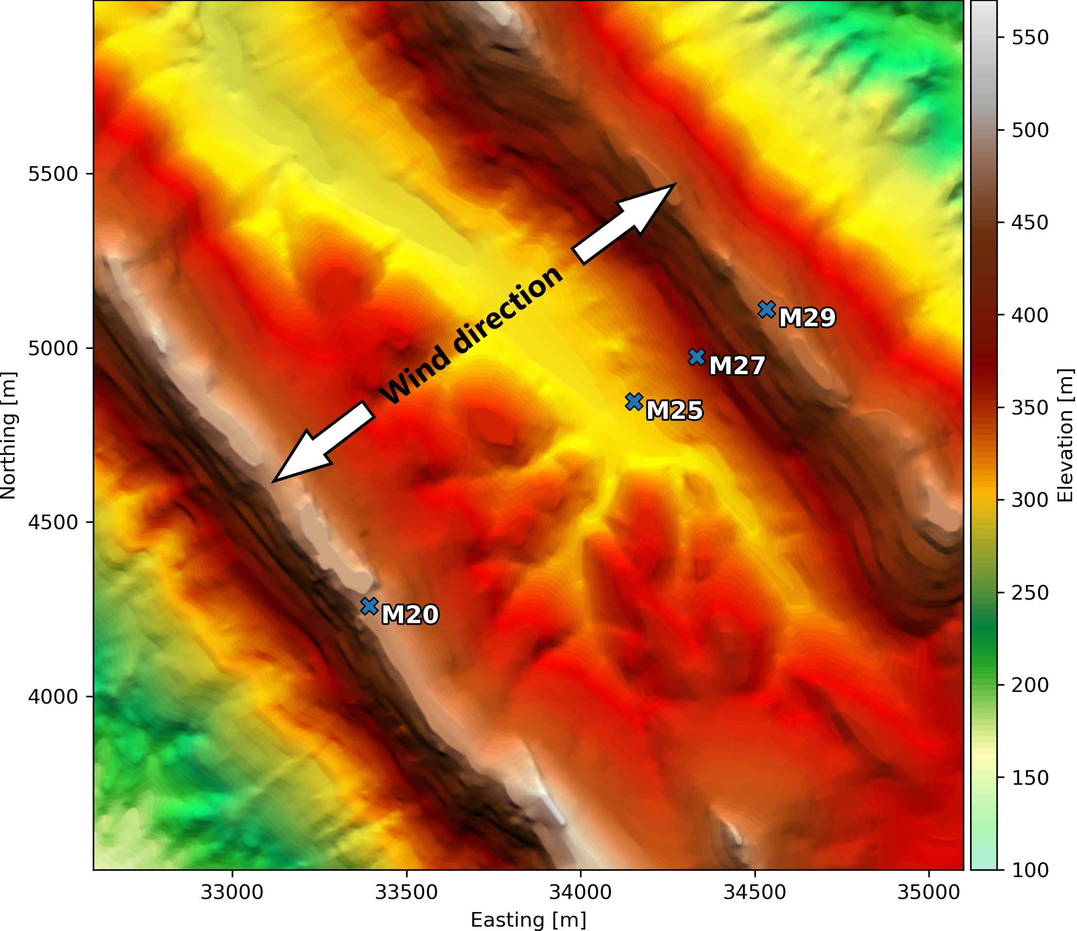
The Perdigão site in Portugal, shown in Fig. 1, consists of two parallel ridges stretching along the northwest-southeast diagonal, perpendicular to the two predominant wind directions: southwest and northeast. During the New European Wind Atlas (NEWA) project, the site was extensively instrumented and monitored (Fernando et al., 2019). The intensive measurement campaign was in the spring and summer of 2017, but measurements from tall meteorological masts continued until spring 2018.
The Perdigão site requires high-resolution modeling to resolve the local wind climate variations, which includes speed-up of the flow over the ridges and slow-down of the flow, or even recirculation, and turning of the wind in the central valley. To illustrate this, we here present mesoscale results from simulations of Perdigão conducted by DTU Wind Energy and compare them with measurements from four of the tall meteorological masts. The measurement cover a period totaling about 5 months, primarily from the spring and summer months in 2017 and the winter months of 2017/2018.
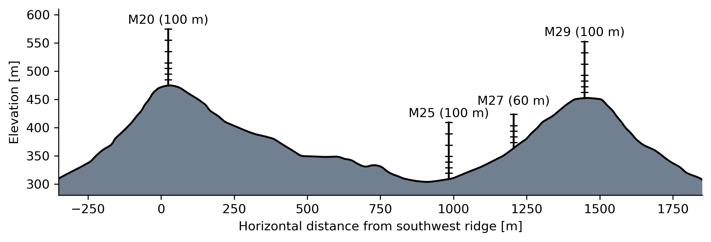
In figure 2 the terrain elevation and positions of the four masts is shown along the transect through the masts.
The mesoscale simulations were carried out using the Weather Research and Forecasting (WRF) model, using four nested domains zooming into the Perdigão region, going from a horizontal grid spacing of 27 x 27 km (d01) to 9 x 9 km (d02), 3 x 3 km (d03), and finally 1 x 1 km (d04). The outermost WRF domain received lateral boundary conditions from the ERA5 reanalysis.
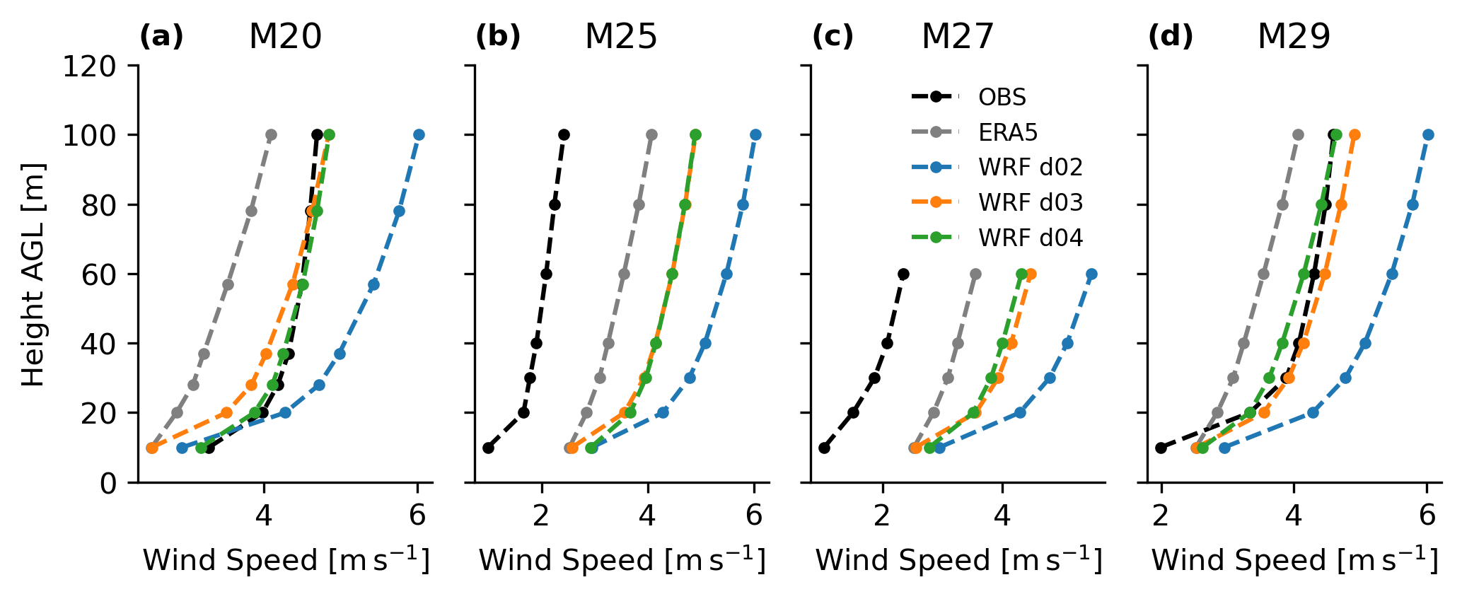
Figure 3 shows the profiles of mean wind speed for the observations and models. The two ridge top masts show similar profiles of measured mean wind speed, while it is considerably lower for the valley masts. Respectively, ERA5 and WRF d02 have a horizontal grid-spacing of approx. 27 x 27 km and 9 x 9 km, and hence show practically no difference in mean wind speeds between the four positions. WRF d03 and especially d04 show some variations in mean wind speed between the masts, but cannot accurately capture the correct variations, ending up with large overestimations in the valley.
For wind resource assessment, it is important to capture the full distributions of wind speed and direction (and other “site” condition variables, but we leave that for now), not just the average conditions. In Fig 4., The wind speed distributions for a number of heights are shown for each mast. It indicates that even though the mean wind speed is captured well by WRF d03 and d04 at the two ridge tops, the distribution is not. Instead, we see too much probability mass at the extreme ends of the distribution (very low and very high wind speed) and an underestimation of the probability mass in the mid-range of wind speeds.

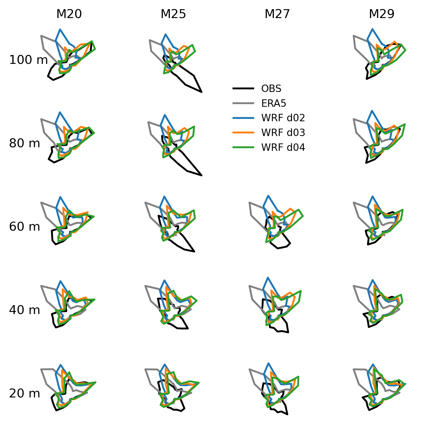
Finally, capturing variations in wind direction distribution is also of vital importance. In figure 5, wind roses for several heights at each mast is shown. ERA5 and WRF d02 have not captured the windrose well, even at the top of mast M20 and M29. This indicates that the meso- or intermediate-scale effects of topographical features in the region, such as the Serra da Estrela complex to the northwest of Perdigao, have not been well resolved in the models. WRF d03 and d04 have captured much more of the mesoscale flow patterns, indicated by the relative improvement at the top of M20 and M29, but have not resolved the central valley, and thus have more-or-less the same windrose for all masts and heights above ground level.
In the HPCWE project, the WRF results presented here are used by DTU Wind Energy and EDF to drive microscale models in order to capture the local wind climate variations , following in the two approaches outlined in this earlier blog post.
References
Fernando, H.J.S., Mann, J., Palma, J.M.L.M., Lundquist, J.K., Barthelmie, R.J., Belo-Pereira, M., Brown, W.O.J., Chow, F.K., Gerz, T., Hocut, C.M. and Klein, P.M., 2019. The Perdigao: Peering into microscale details of mountain winds. Bulletin of the American Meteorological Society, 100(5), pp.799-819.