Success Story: Offshore Wind Resource Assessment from Limited Onshore Measurements

ORGANISATIONS INVOLVED
![]() The University of Nottingham performed the data fusion study.
The University of Nottingham performed the data fusion study.

The Technical University of Denmark offered the raw data collected from LiDAR measurements and numerical simulations.
![]()
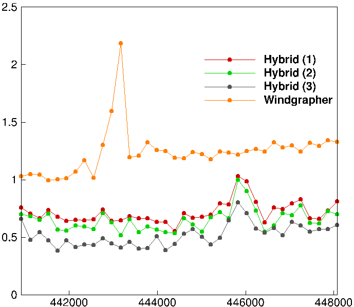
Goldwind, a world leading wind turbine technology and energy solutions provider, compared the present solution with that from Windgrapher, an industrial package for wind resource assessment.


THE CHALLENGE
In the past decades, there has been worldwide demand for renewable energy, leading to a dramatic expansion in all its sectors, with a significant fraction generated by wind. Before the construction of a wind farm, it is critical to evaluate the wind speed condition of the location. Since the power is the cube function of wind speed, minor speed changes can cause large deviations in the output power. Moreover, the wind varies both geographically and temporally over a wide range of scales. Therefore, an accurate assessment of the wind resource for a proposed site is highly essential and is considered of paramount significance for a wind project to be successful. The assessment also helps to the selection of wind turbines and their layouts.
Wind can be measured using physical measuring devices including LIDARs or masts, which are a source of high-fidelity data, but are expensive and scarce in space and time, particularly for onshore sites. On the other hand, numerical simulations, using for example the Weather Research and Forecasting (WRF) model, generate temporally and spatially continuous data with relatively low fidelity.


THE SOLUTION
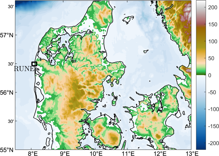
A hybrid approach is proposed here to combine the merit of measurements and simulations for the assessment of offshore wind. Firstly, a temporal data fusion using deep Multi Fidelity Gaussian Process Regression (MF-GPR) is performed to combine the intermittent measurement and the continuous simulation data at an onshore location. Then a spatial data fusion using a neural network with Non-linear Autoregression with external input (NARX) IS conducted to project the wind from onshore to offshore. The method was tested using a coastal region in the west of Denmark and yielded significantly better assessment than the industrial package Windgrapher.
IMAGES

BUSINESS IMPACT

Wind resource assessment is the most important step in planning a wind farm. It is the basis for acquiring finances through determining initial feasibility and cash flow projections. Since the power is the cube function of wind speed, minor speed changes can cause large deviations in the output power. Power curves play an ultimately important role in improving the performance of wind energy-based systems, and aids in energy assessment, and performance monitoring of the wind turbines.
BENEFITS
The data fusion-based approach enabled significant computational assessments of offshore wind without the need to purchase and maintain expensive LIDAR equipment. This allows for a far better and cheaper understanding of the available wind resource at the site to ensure that the predicted energy production and therefore revenue from the wind farm is accurate.

Any questions related to this success story? Please contact us via our contact form.

